Hikers with ID
Matching each hiker with the right trails can help hiking planners and partners to find the perfect hike.
How can I find trails now?
A detailed inventory of hikes in our region reveals just how overwhelming the choices are for beginners
How are trails rated?
The criteria for rating trails of varying levels of difficulty are not that useful to beginning hikers with ID!
Access adventure
Using existing data to carefully cali- brate hikes that help beginning hikers grow over time into adventurous ones.
Building a trail inventory
Applying progressive access to the inventory of trails in our region reveals a wealth of great options.
Evidence-based practices
How can you adapt core EBPs identified for other skills and behaviors to hiking?
A community of hikers!
Imagine creating new social connections, and building a regional trail inventory together!
Coming soon
 Hiking is for everyone in Kennett Square!
June 20, 2020
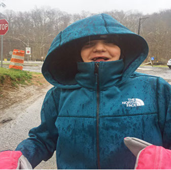
.jpg?crc=3890483898) Getting ready to hike at CheslenPeople with intellectual and developmental disabilities (or I/DD), like my daughter Margot, face special challenges to their health and quality of life. While others might learn a sport or develop a fitness routine in school or college, this a lot harder for people with ID. And so they struggle to find healthy activities to enjoy, and are more likely to be overweight.
Getting ready to hike at CheslenPeople with intellectual and developmental disabilities (or I/DD), like my daughter Margot, face special challenges to their health and quality of life. While others might learn a sport or develop a fitness routine in school or college, this a lot harder for people with ID. And so they struggle to find healthy activities to enjoy, and are more likely to be overweight.
Helping people with I/DD learn to enjoy a short hike can begin to solve these problems. It requires no specialized equipment, and a trail is almost always nearby. So where do you start? Read more below, and check out our curated trail guide, with almost 40 trails within a 30 minute drive of Kennett Square. Many of these have already been verified by Margot, and given her seal of approval!
Know your hiker
Hikers will grow to love short hikes, once they know what to expect. The key?
- Make sure that you know what your hiker finds more interesting and more difficult, and offer just the right challenge.
- Hikers with poor balance, coordination, or muscle tone may need extra time and support
- Hikers may be especially frustrated at first when you are making them work hard, so watch for the signs, and adjust as needed.
Read more here
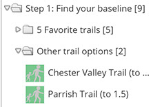
Step 1: Find your baseline, and establish a routine
How far can you comfortably hike in 30 to 60 minutes? 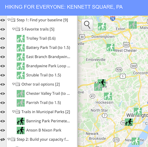
-
Use our
trail guide
or go straight to our custom
ScribbleMap
(see right) to find a beginner trail (a flat, paved or stone dust trail less than 1 mile long) within a 15 minute drive from your house. Expand the folders on the ScribbleMap under Step 1, and click on any green icons with white hikers in the folder or on the map itself to open up the description, including a link to the trail map itself.
- Start with our 5 favorites: easy, peaceful, and scenic trails, like the Struble Trail or the Trolley Trail.
- It is hard to find short, paved loops, so most hikes will involve walking on a trail and then turning around once you reached a halfway point, based on how far or how long you want to walk.
- While hiking, you can follow your progress on the map, though you might need to register for free with Alltrails. You can get get driving directions to the trailhead by clicking on the link in the Scribblemaps description.
- Take a 10, 20, 30, or even 60 minute hike! How far can you comfortably walk for… a half-mile? A mile? Repeat this two more times on this trail, and work towards a steady pace without making this too difficult for your hiker.
-
The key to increasing hikes gradually is to
watch your hiker's effort
. How do they tell you, by what they say or do, that this getting too hard?
- My daughter shows this in many ways: she frowns, grimaces, grinds her teeth, and may try to hit me or slap her head. If she does any of these behaviors in a row or together, I know that this is beginning to get hard for her. If she does this continuously for more than 30 to 60 seconds, I know that this is beginning to wear her down.
-
Click on right-facing triangles to close folders and shrink the menu
 Click on downward-facing triangles to open folders to expand the menu, and then click on the icon to see more information on the trail. You can also
 click here to show these trailsorclick here to hide these trailsShowing trails you are interested in and hiding the rest makes the map easier to use, especially on a phoneScribble Map Tips
Make sure this first hike is all fun, by watching for these behaviors that might signal that your hiker is becoming uncomfortable. Don’t push too hard!
click here to show these trailsorclick here to hide these trailsShowing trails you are interested in and hiding the rest makes the map easier to use, especially on a phoneScribble Map Tips
Make sure this first hike is all fun, by watching for these behaviors that might signal that your hiker is becoming uncomfortable. Don’t push too hard!
- Don't worry if your hiker begins to struggle when you are about 3/4s through - that is ok! If they begin to struggle before even getting halfway, then you may be trying to go too far too fast.
- Bad weather increases your hiker's effort, so avoid hiking on days that are especially hot, cold, or rainy at this point – you can try this later!
- After you have hiked a first trail successfully 2 to 3 times, choose another baseline trail from the guide that is about the same length. Once you have hiked successfully 2 or more times on this second trail, you have found your baseline. Now you can move to the next step, starting from this baseline to build your capacity for longer and more difficult hikes!
- Also use these first hikes to build a routine that you can comfortably and reliably implement once or twice a week. Is there another outing your can pair this with? Can this be used to break up a stretch of the day when your hiker is otherwise restless. For example, when we are looking to fill a day with little else planned, we know that Margot gets bored if she stays home past 10AM. We can add a one hour hike at 10, and when she is done, she is ok if we just hang out at home for another 60-90 minutes.
Read more about these guidelines here. Find still more trails near Kennett Square where you can establish your baseline here.
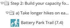
Step 2: Build your capacity for longer and more difficult hikes
Take hikes that gradually require more effort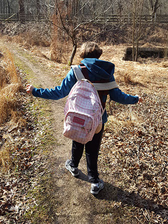 Heading out at Harmony Hill
-
All trails in our guide are assigned an
effort score
based on the length, slope, and the surface of the trail. This is marked in brackets () throughout. You can see how effort scores are calculated by looking at our
summary
.
- Each half-mile of paved flat trail counts as 1. For example, a flat 1 1/2 mile hike counts for 3.
- Any 1/2 mile section with a steeper slope requires more effort and so has a higher total rating. For example, a 1 1/2 mile hike that includes a 1/2 mile section with at least 300 feet that is steeper (with a slope greater than 1:10 or a 10% grade) counts as 4.
-
Decide where to go next, based on what you comfortably hiked in Step 1, using the effort score established as your baseline above, and following the steps below.
- All trails at this stage are wide, with few obstacles. Narrow, steeper trails with rocks and roots are best saved for later, because they will require even more effort.
A) Use our trail guide to find an easy, paved trail that is up to two miles long, and work your way up gradually to hiking 1 1/2 miles in under 90 minutes (3), if that is not already the baseline you established earlier.
-
Beginning with Step 2, maximum effort ratings are indicated in brackets next to the trail name (like 7.4 for the Battery Park Trail, a flat paved path that is about 1.8 miles each way)
 Scribble Map Tips
Expand the folders on the
ScribbleMap
under Step 2 (Build your capacity), and then again under (a. Longer,easy paved trails). Click on any blue icons with
white
hikers in the folder or on the map itself for more information: a link to a trail map, a link for getting driving directions, other details about the trail, and so on.
Scribble Map Tips
Expand the folders on the
ScribbleMap
under Step 2 (Build your capacity), and then again under (a. Longer,easy paved trails). Click on any blue icons with
white
hikers in the folder or on the map itself for more information: a link to a trail map, a link for getting driving directions, other details about the trail, and so on.
- If your baseline was a 1/2 mile hike (1), try to increase this to 1 mile (2). If your baseline was a 1 mile hike, try to increase this to 1 1/2 miles (3).
- Before trying something harder still, establish a new baseline by successfully repeating that hike at least 2 more times. One you have a new baseline of 3, move on to the next level.
- The Brandywine Park Loop (2) is a great place to start! You can move on to the next step when your new baseline is a 1 1/2 mile hike in under 90 minutes, like on the Battery Park or Struble Trails in under 90 minutes.
Check the guide often, to see what other trails have been added!B) Next, look for a gently sloped, paved trial. Click on any blue icons with gray hikers in the folder or on the map itself for more information. These more difficult trails include at least one 1/2 mile section with an average slope between 1:20 and 1:12.
- Be careful to not to increase your effort by more than a point. For those able to hike 1 1/2 miles on a flat trail (3), the Auburn Valley Trail (3.75) is a great place to start trying hikes with gently sloped sections.
- Before trying something harder still, establish a new baseline by successfully repeating that hike at least 2 more times. You can move on to the next step when your new baseline is a 1 1/2 mile hike on a gently sloped, paved trail in under 90 minutes, like the Bellevue Section of the Northern Delaware Greenway (5.6), or the Pocopson Trail (6.1).
C) Finally, try a hike on a flat, smooth, wide natural trail. Click on any blue icons with black hikers in the folder or on the map itself for more information. The occasionally uneven surface (rocks, roots, muddy sections, and so on) can make these hikes harder, especially for hikers with poor balance.
- Try to choose a first natural path that requires the same or less effort as the most difficult paved trail you can comfortably do, For example, if you can comfortably hike a paved 4 trail, choose a natural trail rated as 2 or 3 from our guide. The Trolley Trail with Extension (1.95) is very safe place to start for all hikers, as it includes only a quarter mile on a natural surface!
- Watch your hiker carefully, to see how hard this is for them. If this does not seem much harder, you can begin adding hikes on other trails requiring comparable levels of effort on smooth natural surfaces.
- You can move on to more adventurous trails when your new baseline is a 2 mile hike on an easy, flat, wide, natural trail in under 90 minutes, like the Western Section of the Springlawn trail (6.3).
Read more about these guidelines here. Find still more trails near Kennett Square where you can build your capacity for longer and more difficult trails here.
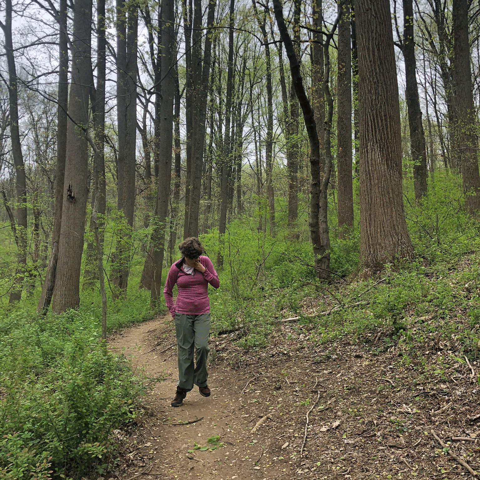
 Wet winter day on the Trolley TrailTry hiking even when the weather is not great Practice adjusting your gear, and your expectations
-
As you become braver with natural trails, become braver with nature by trying to hike in less than ideal weather. No need to stay at home when it is especially hot, humid, cold, or rainy. Just be prepared to make some adjustments
- Choose an easier hike. If you normally hike a 4 trail, try a 3. Margot's overall endurance and mood is definitely impacted when she is not is comfortable, so we just adjust our expectations.
- Experiment with different apparel. When do they need a hat or gloves? When they need to shed a layer or two? Maybe they need help keeping a hat, sunglasses, or gloves on, but don't give up! It took two years of skiing and biking in the cold before Margot realized that these help keep her comfortable. Now she barely notices when she hikes on a 40 degree rainy day on the Trolley Trail.
- Learning to hike in poor weather is REALLY important! It helps take hiking from a spring and fall activity to a summer - and, yes, even winter - activity
 Taking a "break" on the Schuylkillget ready to be even more adventurous!
At this point, some hikers may be eager for even greater challenges. This is the right time to practice other skills you will need for even more adventurous hikes.
Practice taking breaks
If you plan on a hike likely to last more than 75 minutes, begin to introduce a short break somewhere around the midpoint.
- Try sitting down for 5 minutes at a bench, or even lying right down on the ground
- Break out drinks and maybe a snack. Even if your hiker just wanders around, it is a start.
This break will give them (and you) a chance to catch their breath. But you are really beginning to create a routine that will become more important if you want to ever aspire to hikes that are much more challenging.
Practice evaluating how your hiker is doing while tracking your progress on a map
It easier to over-estimate your hiker's capacity on more adventurous hikes. Why? The hikes are longer, and can include much more difficult sections (like steep slopes, narrow trails, many obstacles, and so on) that can quickly sap your hiker's energy. To prevent being caught unprepared, you will need to be able to monitor your hiker even more carefully and frequently. More adventurous hikes require that, 25-30% into your hike, you decide whether to abort or to continue. And to decide this, you will need to be able to identify more difficult sections beforehand, and then track your progress on a map. How do you practice this?
- Make sure your smartphone is charged before you leave. Open the Google or Alltrails map of the trail itself before you hike, and make sure you can see where you are on the trail. Check your phone periodically as you hike.
- Get used to checking in with your hiker at the 25%, 50%, and 75% mark. They should have happily hit their stride at 25%, just begun to sweat at 50%, and clearly show effort at 75%. Use this information to adjust support for this hike if needed (like more encouragement or an earlier break if they are struggling sooner than expected) and to re-calibrate your expectations for the next hike, so that you can choose just the right challenge.
- Get used to reviewing the trail description for any relevant information about the features or particular segments of the hike (like a steeper section) that might prove more difficult. See if you can identify these features as you hike, and then watch how your hiker responds. This will help you to learn which of these features are especially challenging for your specific hiker.
Step 3: Explore even more challenging trails
 Hopping along Harmony HillA) Use our trail guide to explore how your hiker responds to each of the specific features typical of many natural trails. Choose trails with an overall effort score that matches the new baseline you established in the last step. For example, if your hiker comfortably completed a 1 1/2 mile hike on a natural trail (6), find a more difficult, natural trail that does not require an effort greater than 6. Work your way up gradually to hiking trails 2 1/2 miles in under 90 minutes that include more difficult sections (e.g., an effort score ranging between 10.5 and 15). You can find these trails by expanding the folders on the ScribbleMap under Step 3 (More adventurous natural trails).
- Begin by exploring how your hiker copes with steeper trail sections by expanding the folders under (a). Click on any pink icons with white hikers in the folder or on the map itself for more information. The Meadow Loop at Stateline Woods Preserve, with a total effort score of 6.7, is a very safe place to start! Work your way up to Springlawn, with a total effort score of 12. Most natural trails include steep sections, so these wide, natural trails with a generally even surface will get you ready for other trails.
- Next, explore how your hiker copes with narrow trail sections by expanding the folders under (b). Click on any pink icons with gray hikers in the folder or on the map itself for more information. Laurel Heights, with a total effort score of 6.3 is a very safe place to start! Work your way up to Whitely Farm Loop West, in White Clay Creek State Park, with a total effort score of 10.6.
- You can also explore how your hiker copes with uneven surfaces by expanding the folders under (c). Click on any pink icons with black hikers in the folder or on the map itself for more information. Trails that are uneven without also being narrow are difficult to find, but the Indian Spring/Hidden Pond Loop, in Brandywine Creek State Park, with a total effort score of 11.8, will be a good test for your hiker.
B) Once your hiker has demonstrated that they are comfortable on trails that are steep, narrow, or uneven, use our trail guide to begin trying trails that combine all of these features. You can find these trails by expanding the folders under (d) and clicking on any pink icons with yellow hikers in the folder or on the map itself for more information. Begin with a trail that does not have an effort score greater than the most difficult trail they have mastered to date. The Forest Loop at Stateline Woods Preserve, with a total effort score of 6.1 is a very safe place to start! Work your way up to the Harmony Hill South Loop with a total effort score of 14.5.
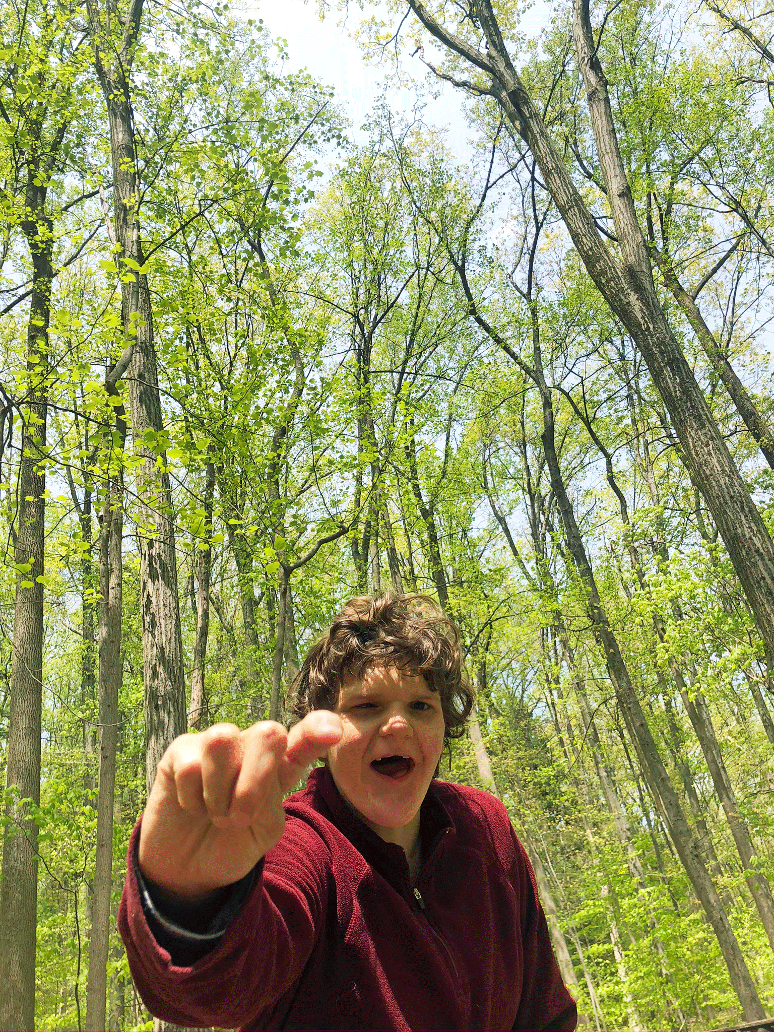 Making her point in NoldeC) As your hiker becomes more comfortable on more difficult natural trails (i.e., that include narrow, steeper sections and uneven surfaces) and that approach 2.5 or 3 miles on length, consider looking beyond the curated lists. This can help you hike successfully wherever you might go!
-
Filter
Alltrails
for hiking trails that are less than 3 miles in length, excluding those rated as difficult. Look for trails with a lot of positive reviews, and scan the reviews for encouraging comments (perfect for children) or warning signs (poorly marked, many obstacles etc).
- When you select the option to view the whole map, Alltrails includes an elevation chart. While this will not capture the more difficult slope of short, steep sections, it will give you a sense of the overall elevation change.
- To be safe, aim for a trail that is 50-70% as long as the most difficult trail your hiker mastered in (B), in case there are difficult conditions that you could not foresee and that no reviewer has commented upon.
- Prioritize trails in state or national parks. These parks often include detailed maps to help with planning (with contour lines, distances, etc.), and some of which can be loaded onto a phone to track your progress. And there are often many cut-offs that give you the option of shortening a trip that has proven to be too long. Alltrails tends to focus on longer trails, and so you may discover a shorter trail option by scanning a map.
- Example in our region? In addition to enjoying the trail networks in White Clay Creek State Park in Delaware (like the Whitely Farm Loops) and the White Clay Creek Preserve in Pennsylvania (like the PennDell Trail), Margot has loved discovering the trails of the Nolde State Forest (like the Watershed and the Boulevard trails) near Reading.
Read more about these guidelines here. Find still more trails near Kennett Square here.
Design by Jeremy Goldberg
Muse-Themes.com
The logo is adapted from Joaquim Alves Gaspar's drawing of Pedro Reinel's compass rose.
Connect
Hikers with ID
Matching each hiker with the right trails can help hiking planners and partners to find the perfect hike.
How can I find trails now?
A detailed inventory of hikes in our region reveals just how overwhelming the choices are for beginners
How are trails rated?
The criteria for rating trails of varying levels of difficulty are not that useful to beginning hikers with ID!
Access adventure
Using existing data to carefully cali- brate hikes that help beginning hikers grow over time into adventurous ones.
Building a trail inventory
Applying progressive access to the inventory of trails in our region reveals a wealth of great options.
Evidence-based practices
How can you adapt core EBPs identified for other skills and behaviors to hiking?
A community of hikers!
Imagine creating new social connections, and building a regional trail inventory together!
Coming soon